For Planning Officers exploring smarter ways to share spatial information
If you’re a planning officer looking for a better way to deliver your Local Plan Policies Map or engage the public with spatial data, OpusMap and OpusConsult might already be on your radar. But what you might not know is how OpusMap can go far beyond planning to support web mapping across your entire Council.
OpusMap is designed to be more than just a Local Plan tool - it’s a flexible, cloud-based platform that can be used by services across your authority to publish, manage, and share maps and location-based information. Here’s how you can start small and scale it up.
1. Start with Planning - Then Think Bigger
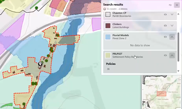
Most councils begin using OpusMap for Local Plans because it makes it simple to publish a compliant, interactive Policies Map, combining your GIS data with the latest Ordnance Survey digital mapping and address data. That alone is a huge win. But once OpusMap is up and running, you’ve got a corporate-ready mapping tool at your fingertips, with no user or map limits. It’s web-based, user-friendly, and built for public engagement - which means it can support other services like regeneration, transport, housing, and the environment without needing separate systems or data silos.
2. Map What You Already Have
The fastest way to prove the value of OpusMap is to start mapping datasets you already use. Whether it’s site allocations, constraints, or brownfield land registers, OpusMap can turn your existing GIS data into clean, professional online maps. There’s no need for coding or complex setup - if you can upload a shapefile or connect to a WMS feed, you’re ready to go.
3. Use OpusMap to Improve Public Engagement
OpusMap isn’t just a tool for planners - it’s a platform for communicating with the public. As part of the Opus system - OpusMap and OpusConsult working together - your interactive maps make consultations clearer and easier to understand, helping people see what’s changing in their area. That reduces confusion, improves public reps and comments, and builds trust. Councils that use OpusMap often see fewer FOI requests because so much useful information is already accessible online.
4. Work with Other Teams to Identify Shared Mapping Needs
Every department has spatial data - but not every team has a way to present it well. Services like housing, environmental health, or transport often rely on PDFs, spreadsheets, or buried documents because access to data and the right tools to make use of that data is problematic - think legacy systems. You can be the link. By showing what OpusMap can do for planning, you can help other teams imagine what it could do for them. Offer to trial a single map together - it’s a great way to start collaboration.
5. Lay the Groundwork for Corporate Use
As you build momentum, involve your GIS and IT teams. OpusMap integrates with existing spatial data infrastructure and doesn’t require expensive hardware or major system changes. If you’re working on digital transformation, transparency, or improving public service delivery, OpusMap supports all three - and helps spatial data work harder across the organisation.
In Summary
OpusMap gives planning teams a modern way to deliver interactive web maps and spatial data - it aids both planners and stakeholders in the planning service. But its true strength lies in how easily it scales corporately. As a planning officer, you understand place and policy better than anyone. That puts you in the ideal position to champion smarter use of spatial data and better public engagement in services across your Council.
Interested in seeing how the Opus System could work for your authority?
Get in touch to schedule a demo: info@jdi-solutions.co.uk