The Opus System: Map & Consult

Consult, Engage, and Map your Local Plan

OpusConsult system mockups featuring OpusMap integration, responsive design, form graphs, and map tool functionality.

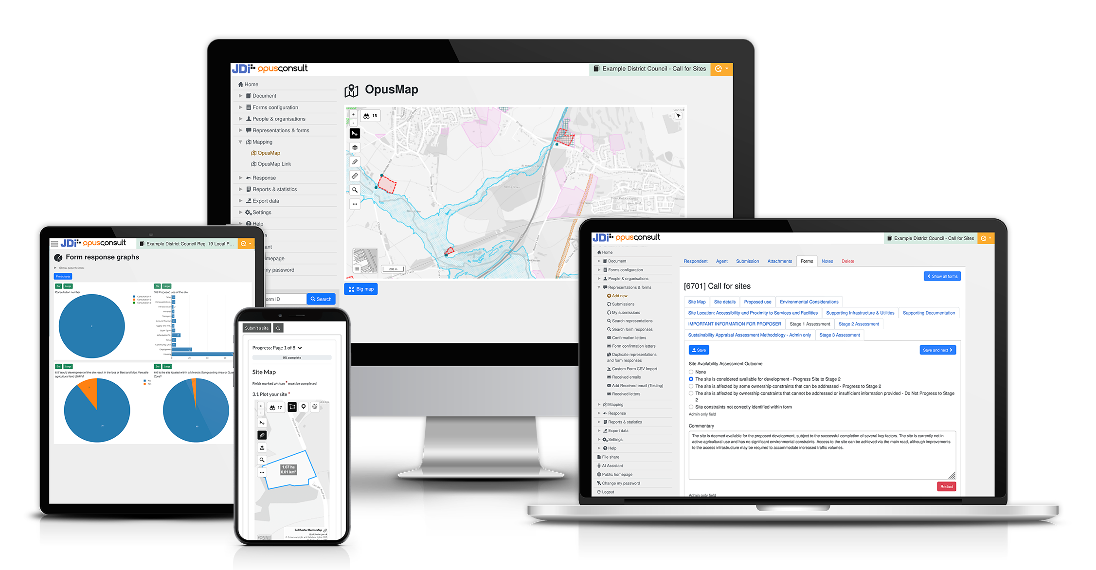
The Opus System: The End-to-End Digital Solution for Local Plan-Making

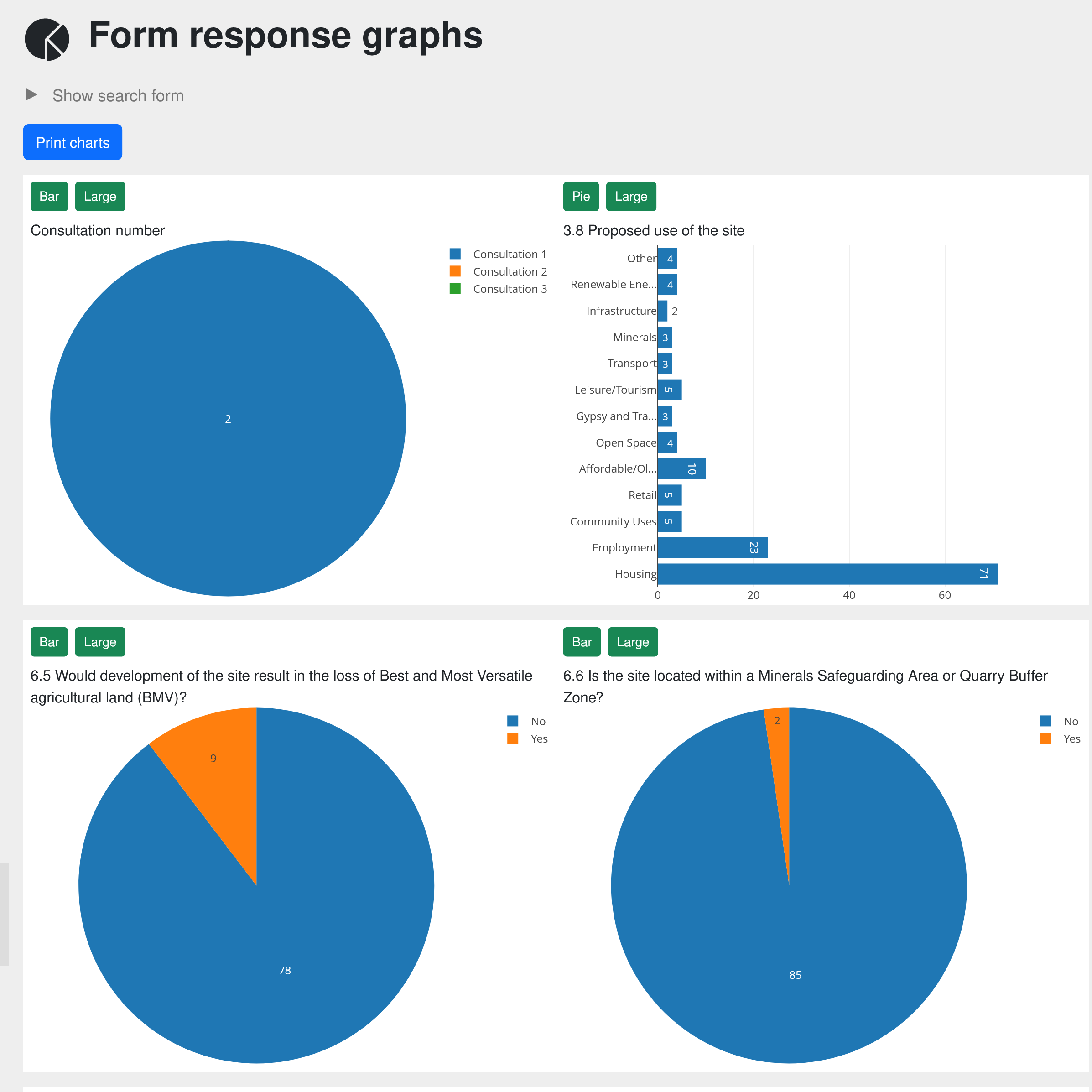
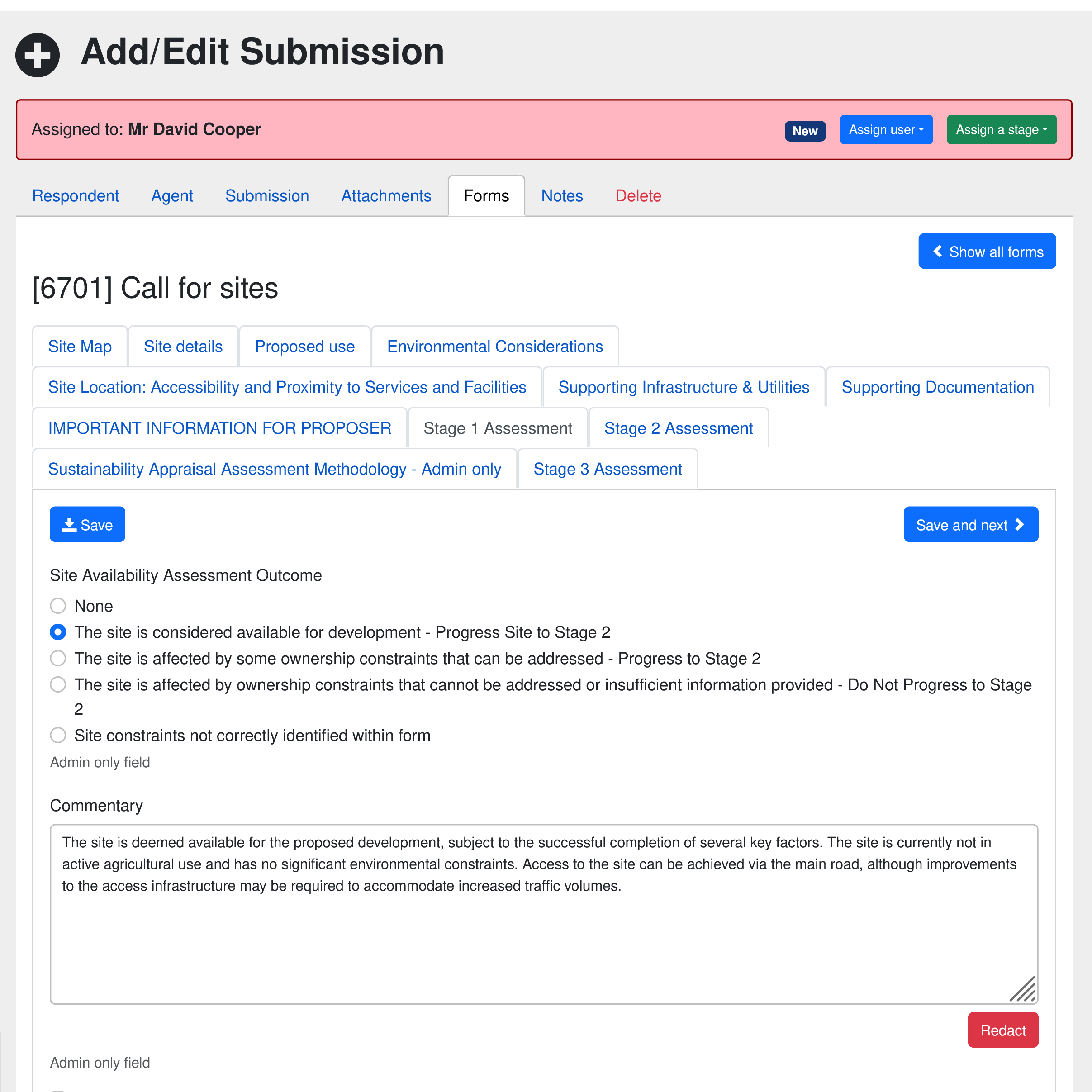
OpusConsult provides the digital tools to streamline and manage every public engagement, consultation and publication stage for a Local Development Plan, from evidence gathering, Call for Sites, regulation 18 and 19 Local Plans, to examination and presenting the adopted plan.

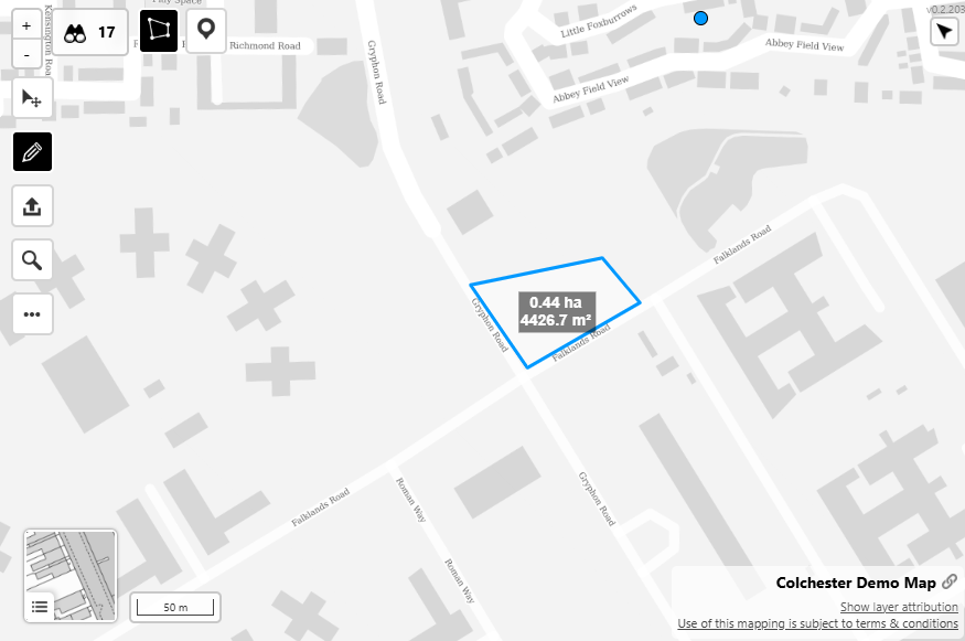
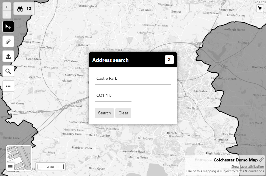
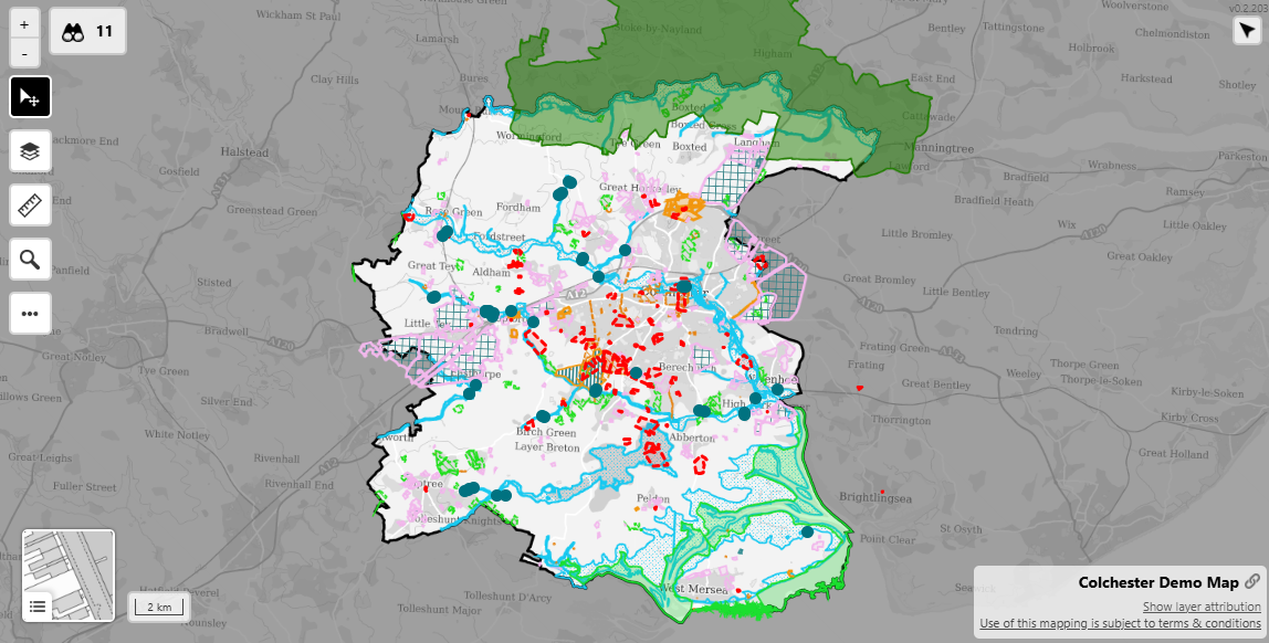
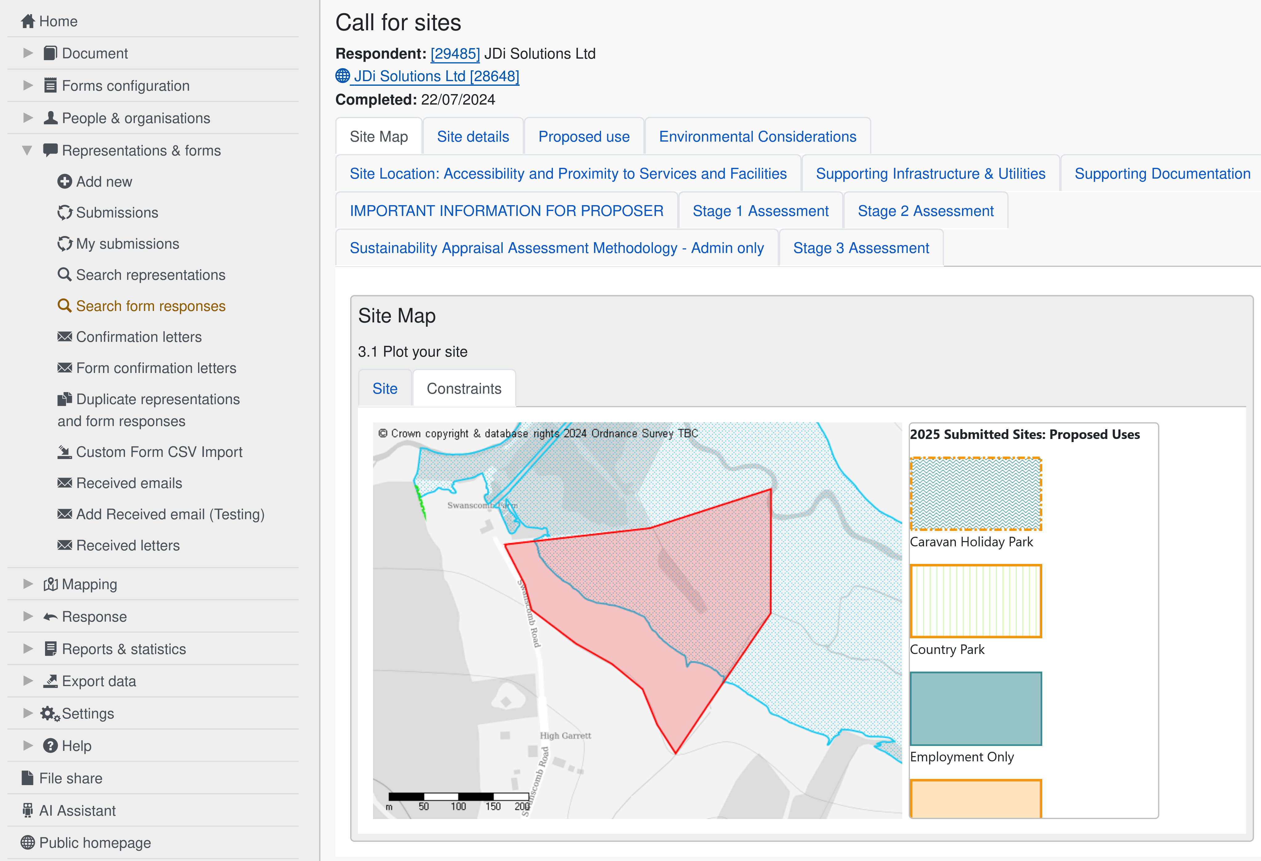
Interactive policies maps, site plotting and automated constraint querying are provided by our integration with OpusMap, supplied by our trusted partners at Blue Fox Technology.

Together, as the Opus System, we offer a complete solution for digital plan-making.

Transform Local Plan-Making

By combining our intuitive specialist consultation platform OpusConsult with cutting-edge interactive mapping software OpusMap, you will revolutionise local plan-making for stakeholders such as the Local Plan team, statutory consultees, local businesses, and community members. Here's how:

  • Enhance Stakeholder Engagement

    • Bring Proposals to Life

      Interactive maps make complex proposals easy to visualise, helping residents, developers, and businesses understand the impact.

    • Simplify Community Feedback

      Community members can highlight concerns, suggest improvements, or support plans either via the web accessible document or directly on the map, for a more intuitive, engaging experience.

  • Communicate More Effectively

    • Simplify Complex Ideas

      Interactive mapping bridges the gap between technical plans and public understanding, reaching audiences of all backgrounds.

    • Streamline Feedback

      Tie public input to specific map locations, enabling planners to address concerns systematically. Centralise all submission data and utilise time-saving digital tools to reduce processing time.

  • Drive Better Decision-Making

    • Analyse with Data

      Overlay data on maps to predict the effects of proposed developments or policies. Access built-in analytics and reports to inform decision-making and present outcomes.

  • Promote Transparency and Accessibility

    • Stay Updated in Real Time

      Keep stakeholders informed with up-to-date plans and data for a transparent process.

    • Broaden Access

      Allow the entire community to view plans online, in a web accessible and mobile-friendly format, encouraging participation from those unable to attend meetings.

Revolutionise Local Planning with the Opus System

Empower your community and elevate local plan-making with the Opus System, featuring OpusMap and OpusConsult. The innovative digital tools enhance transparency, foster engagement, and support data-driven decisions – building a more inclusive, effective, efficient, and community-centered planning process.

Keen to go a step further? For ambitious goals of boosting community satisfaction and participation, our interactive Virtual Exhibition Rooms and dedicated Local Plan Engagement Websites offer exceptional solutions. Present your plans in the most visually appealing and accessible format that enhances user experience and maximises engagement.

Ready to redefine your approach to local planning?