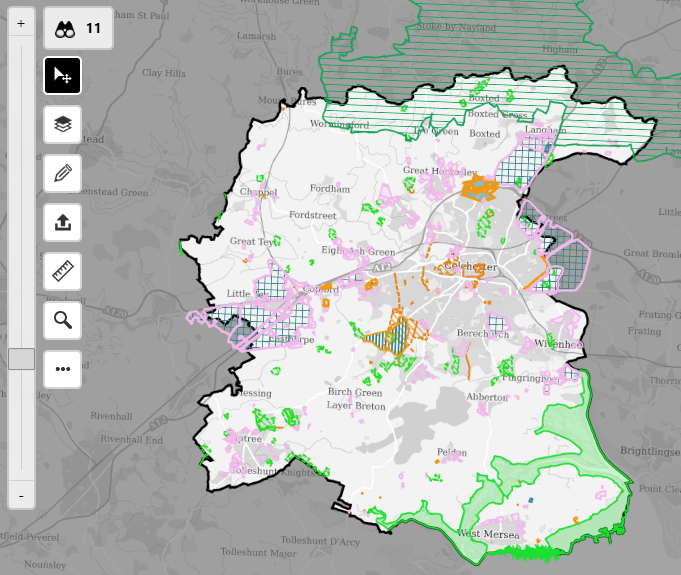
Embedding an interactive map within a digitalised Local Plan document can provide numerous benefits, particularly in the context of urban planning and public engagement. Here are some compelling reasons to do so:
1. Enhanced Visualisation
Improved Understanding: Interactive maps can display complex spatial data in a more comprehensible and visually appealing manner, helping stakeholders better understand the geographical aspects of the plan.
2. Dynamic Content
Real-time Updates: Unlike static maps, interactive maps can be updated in real-time to reflect changes in data, ensuring that users always have access to the most current information.
3. Interactivity
User Engagement: Users can interact with the map, zooming in and out, clicking on specific areas for more information, and toggling different layers of data, making the document more engaging and informative.
4. Accessibility
Improved Navigation: Users can easily navigate to specific areas of interest, search for addresses or locations, and access detailed information about various elements within the map, enhancing the accessibility of the document.
5. Data Integration
Layered Information: Interactive maps can integrate various data layers (e.g., zoning, transportation networks, environmental features) in one place, providing a comprehensive view of the planning area.
6. Stakeholder Involvement
Public Participation: Interactive maps can be a valuable tool for public consultations, allowing community members to explore proposed plans, provide feedback, and visualise how changes might impact their local area.
7. Analytical Tools
Data Analysis: Interactive maps such as those powered by the Opus system, include built-in analytical tools that can help users conduct spatial analysis, identify patterns, and make data-driven decisions.
8. Cost-Effectiveness
Resource Efficiency: By embedding interactive maps, planners can reduce the need for printed maps and documents, which can be costly and environmentally unfriendly. It also allows for easier distribution and access to the plan.
9. Scenario Planning
Future Projections: Planners can use interactive maps to showcase different scenarios and their potential impacts, helping stakeholders visualise future developments and make informed decisions.
Summary
By embedding an interactive map within a Local Plan document, planners can create a more dynamic, informative, and user-friendly resource that better serves the needs of the community and enhances the planning process.
The Opus system includes digital tools for interactive maps to easily be embedded within Local Plan consultation documents, with two-way links between maps and documents. The interactive mapping software within the Opus system is also popular with our customers for Call for Sites consultations.
Perhaps, for example, consider showcasing an accessible and interactive policy map within your Local Plan document powered by OpusConsult, enabling the public to be able to quickly identify and engage on spatial plans that particularly matter to them.
Find out more about how the Opus system consisting of OpusConsult and OpusMap, can help your Planning Policy team to engage with your community more effectively on Local Plan consultations.