Many planning officers assume digital mapping is something best left to the GIS team or to data experts. But that’s changing, fast.
A senior planning officer with decades of experience recently told us: “I didn’t think I’d ever be editing map data myself.”
They said this, moments after successfully updating their council’s Policies Map using OpusMap, without needing any help from GIS colleagues.
This isn’t an isolated story. More and more Local Plan teams, both big and small, are stepping into digital territories once considered off-limits or difficult. And it’s transforming the way they work.
Here are five key takeaways on how and why:
1. Digital mapping confidence is now an integral part of today’s planning toolkit
In the past, spatial data felt like someone else’s job, something to delegate or pass to another department. If you needed a map layer updated, you’d raise a ticket and wait. But with today’s plan-making timelines, that delay can mean missing opportunities to engage, publish, or report. It can have a negative domino effect on timetables and deadlines. And Local Plan timetables and deadlines are only becoming shorter.
OpusMap empowers planning teams to work directly with their own data, securely and safely. It’s not just software training. It’s about learning how to take ownership of the information that underpins your policies and decisions and having the confidence to make changes to that information to support your needs.
2. You don’t need to be a GIS expert to make map and spatial updates
One of the biggest surprises for new users is just how intuitive OpusMap is. The same as it is with consultation software OpusConsult, we continue to prioritise its updates and new functions for planners, not GIS specialists. That’s why everything is made accessible 24/7 through a standard web browser. A familiar interface helps build confidence in managing your maps and data.
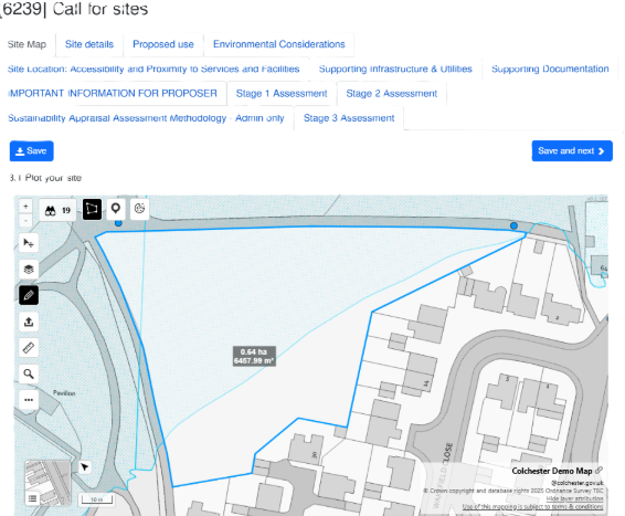
With our onboarding and training sessions, officers can start editing proposed site boundaries, adding new policy designations, or adapting constraint layers for public consumption - like Local Plan consultations - and for internal consumption - like site assessments. No coding. No technical jargon. Just clarity and control.
3. Local and national datasets at your fingertips: your data your way
OpusMap brings together local datasets like policies and allocations with national datasets such as flood zones, Green Belt or conservation and heritage assets. It puts them together in one place and empowers you to manage them as like-for-like data assets. If distinctions have to be made about spatial data, OpusMap allows you to make them on your terms.
Planners can overlay, edit, and query spatial data and map layers to tell a clearer spatial story, one that’s directly relevant to plan-making and stakeholder engagement in your area and one that is based on your own local planning knowledge and experience and in response to feedback from your stakeholders.
4. Consultations become a two-way data flow
Call for Sites and other engagement exercises often result in a flood of data, some of it digital, some still on paper. OpusMap helps format and standardise that disparate data into something coherent and consistent to support the specific actions and outcomes that benefit you and your team.
Users can add new sites, tag representations, and track how land is promoted or assessed across the plan period. This reduces duplication and gives your team a single, authoritative view of what’s in play. No more data disappearing down the GIS rabbit hole or assigning days and weeks of officer time to converting paper into data.
5. Planning teams become true data custodians
Digital mapping isn’t just about software or the latest technologies (Hello AI!). It’s about developing a mindset. When planners feel confident editing, updating, and presenting spatial data, they stop relying on others and start leading the conversation about what their data represents and how it relates to their own digital plan-making workflows and processes. Confidence in data helps you to get stakeholders to buy into your digital plan making goals and aspirations, working with you through the process rather than against you.*
Data custodianship not only speeds things up, it also builds a more collaborative relationship between policy, GIS and IT teams, that isn’t based on who’s the boss of the latest technical jargon but by reaching a collective understanding of your requirements for that data.
*Imagine running a Call for Sites consultation where 97% of proposals are submitted using OpusMap and OpusConsult and where proposed sites are assessed in less than 3 weeks. Imagine the positive impact that turnaround time has on stakeholders in the abilities of the Local Plan team to get things done. This is the experience of Powys County Council when they ran their last Call for Sites consultation.
Final Thought
The future of plan-making belongs to those who can see it, and shape it, on a map. When planning teams build a collective confidence in working with data by using digital tools like OpusMap, they don’t just speed up workflows, they unlock the power to lead a spatial strategy from the front, for all stakeholders. This isn’t about replacing GIS. This isn’t about “throwing the baby out with the bathwater” and starting again. It’s about planners taking ownership of the data that drives their decisions. Because in today’s planning landscape, digital confidence isn’t optional. It’s transformational.
Are you open-minded to explore how the Opus System could work for your team?
You don’t have to be a GIS specialist. You just need the right tools, and the confidence to use them. That’s OpusMap!
If you’re part of a Local Plan team and this sounds like the direction your council needs to go, we’d love to show you how OpusMap can help. Add OpusConsult to the mix and we can show you even more win-win strategies and efficiency gains.
Get in touch to schedule a demo of the Opus System: info@jdi-solutions.co.uk